Drishti: satellite change detection for unauthorized construction enforcement
A ranked, evidence-backed inspection worklist built on tiered satellite imagery, three-class change detection and a legally defensible human-in-the-loop. Built for a metropolitan development authority.
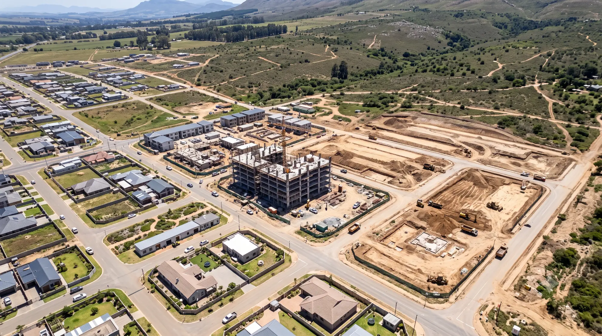
Where the pain concentrates
Authorities can usually demolish once a structure is found. The gap sits upstream: nothing systematically looks until an enforcement drive or a public tip does. By then the structure is already entrenched, surrounded by other recent construction, and politically harder to act on than it would have been three months earlier.
Enforcement outpaces detection
Authorities can usually demolish once a structure is found. The gap sits upstream. Nothing systematically looks until an enforcement drive or a public tip does.
Structures surface once entrenched
By the time a case lands on an inspector's desk, the construction is usually surrounded by other recent builds and politically harder to act on.
False positives are legally expensive
A notice or demolition is legally consequential. At scale, change-detection models produce false positives often enough that no notice should ever be automatic.
Ownership data is a compliance trapdoor
Matching flagged parcels to tax and ownership records touches personal data. That step needs a formal agreement first, not a v1 feature.
What the platform says, out loud
One pipeline, three satellites, a human-gated verdict
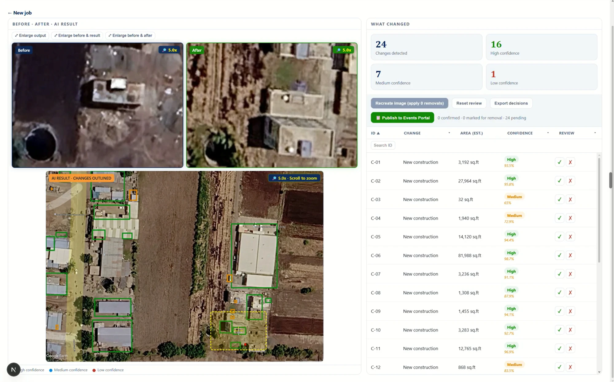
Drishti scans a metropolitan authority's full jurisdiction on a 30-day cycle, flags new construction, earthwork and sheds with a confidence score, and hands every case to a human inspector with the source imagery attached. The platform never issues a notice. It produces a ranked worklist. The decision stays with the authority.
The design decision came first: a notice or demolition order is legally consequential, and a change-detection model at scale will produce false positives. No notice should travel through an automated path. Drishti is deliberately a ranked worklist, not an auto-notice engine, and the ownership and tax-base layer sits behind a documented data-sharing agreement rather than appearing in v1.
What runs today in the pilot ward: tiered imagery triage across Sentinel-2, Sentinel-1 SAR and Cartosat-3; a three-class change classifier with confidence scoring; a monsoon-proof SAR fallback; and a full audit trail that lets a decision taken six months ago be reconstructed and defended.
A legally consequential act never travels through an automated path. The inspector sees the imagery, the score and the context, and decides.
Five building blocks, one defensible worklist
Each block carries a specific job between the imagery pipeline and the inspector. Together they make satellite change detection safe to put in front of a legally exposed enforcement workflow.
Tiered imagery triage
Sentinel-2 optical and Sentinel-1 SAR scan the whole region continuously. Cartosat-3 precision imagery, free to government entities under India Space Policy 2023, is spent only on tiles already flagged. The Cartosat-3 cost line stays flat as coverage grows.
Three-class detection with confidence
The model does not just say something changed. It classifies each change as construction, earthwork or shed, and attaches a confidence score. The inspector sees a ranked case with a probability, not a binary alert.
Monsoon-proof scanning
Optical imagery is useless under cloud cover. Sentinel-1 SAR keeps scanning through clouds. The pipeline switches to SAR-primary during cloud-heavy windows and back to optical-primary when the sky clears.
Human-gated worklist
Every detected change lands in a ranked worklist. The inspector sees the before and after imagery, the confidence score and the classification, and decides: schedule verification, close as false positive, or escalate. The platform never auto-notices.
Full audit trail by design
COG tiles for imagery. A STAC catalog for discovery. PostGIS for parcel geometry and change records. Every case keeps its source imagery, score and disposition, so a decision taken six months ago can be reconstructed and defended.
Scan
Sentinel-2 and Sentinel-1 run continuous wide-area triage on a 30-day cycle.
Triage
Change detection on the free layer identifies tiles with potential change against the baseline.
Zoom
Cartosat-3 precision imagery is pulled only for the flagged tiles, under India Space Policy 2023 access.
Classify
The three-class model labels each change as construction, earthwork or shed, with a confidence score.
Rank
Changes are ranked by confidence and policy relevance into the inspector worklist for the ward.
Inspect
The inspector reviews each case with before/after imagery, score and surrounding context.
Decide
Schedule field verification, close as false positive, or escalate. The platform never auto-notices.
Audit
Every decision is kept with its source imagery, score and disposition for later audit.
Before, after, change
| Dimension | Before | Phase 1 | Change |
|---|---|---|---|
| Detection method | Manual patrol, public tips | Automated 30-day scan | Systematic |
| New changes flagged per cycle | Not tracked | 34* | Visible |
| Confirmed correct on inspection | n/a | 86%* | Measured |
| Flag-to-confirmation time | Weeks to months | 2.4 days* | Collapsed |
| Automated notices issued | n/a | Zero | By design |
*Pilot ward numbers, measured on the first operational cycle. Confidence intervals widen with scale and will be re-baselined as the platform rolls out ward by ward.
Scaling the enforcement surface
Multi-ward scale
Roll out from the pilot ward to the authority's full jurisdiction, keeping the Cartosat-3 cost line flat through the triage design.
Historical baseline reconstruction
Backfill scans against archived imagery to anchor a starting point for tax-base reconciliation and long-run trend reporting.
Ownership and tax base module
Launched behind a formal data-sharing agreement. Match flagged parcels to tax and ownership records inside the compliance boundary that work requires.
Authority leadership dashboard
Ward-level enforcement coverage, flag conversion rates, recoverable assessment value and trend over time, for authority leadership and planning cells.
Mobile inspector interface
Field verification without a desktop. Ground-truth evidence captured back into the case record on the spot.
Multi-authority tenancy
Package the platform for other metropolitan development authorities with per-authority tenancy and audit isolation.
Three principles we are taking into the next engagement
A legally consequential act never travels an automated path
The platform is deliberately a ranked worklist, not an auto-notice engine. For a buyer in an enforcement role, this is the sentence that unlocks procurement. Automated notices would be a liability. A human-gated worklist is a tool.
Spend precision imagery only where cheap imagery flagged it
Sentinel-2 and Sentinel-1 cover the whole jurisdiction continuously and free. Cartosat-3 gets spent only on tiles already flagged. The economics scale across thousands of square kilometers without a runaway cost line.
Audit is a product feature, not a log file
Enforcement decisions get challenged. Keeping every flagged case with its source imagery, confidence score and inspector decision is what lets the authority defend the action six months later.
Managing thousands of square kilometers of urban and peri-urban territory?
ScroBits builds the imagery pipeline, the detection model, the inspector worklist and the audit layer. Talk to us about scoping a pilot ward for your authority.